Geotechnical
Infrastructure refers to a set of systems and services that provide the necessary foundation for the successful execution of activities in a country or region. Most infrastructures like roads, railways, bridges, and tunnels are physical, which we use repeatedly in our daily lives. These infrastructures also extend to a network of buried utilities such as power and telecommunication lines, water and gas pipes, drainage, and sewage. These types of infrastructures are usually less directly used and are hidden from our sight.
Infrastructures, on one hand, form the backbone of modern economies, and on the other hand, like a capillary network, facilitate communication between various components. Investment in infrastructure leads to economic growth and is considered one of the criteria for development. A part of the technical studies for infrastructure development, as well as their proper protection and maintenance, is carried out using geophysical equipment. Geophysical equipment is always considered an essential tool in structural studies and their maintenance.
There are various geophysical equipment that can be used for infrastructure studies and investigations. Geophysical studies provide small- or large-scale structural information about the ground and its geotechnical characteristics. One of the primary advantages of geophysical studies is that information can be obtained for a vast volume of ground and not just a single point. Compared to drilling, geophysical methods are non-destructive methods that can provide valuable information in less time than other methods.
Among the various geophysical methods, three methods: seismic, GPR, and geoelectric, are more commonly used in geotechnical studies. Other geophysical methods such as magnetometry, electromagnetics, and gravimetry are rarely used. The type of challenge and the targets under study determine the method and also the equipment to be used. To solve some challenges and achieve desired goals, the use of several methods and the integration of their results is inevitable. The combined use of several geophysical methods simultaneously usually leads to improved accuracy.
Application of Seismic Method in Geotechnical Studies:
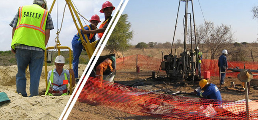
Today, the seismic method has become a standard test for some geotechnical studies, and this test must necessarily be performed. For example, determining soil type with seismic studies based on "Building Design Code Against Earthquake, Standard 2800" is mandatory in many cases. Downhole seismic testing, as well as surface seismic testing using the MASW (Multichannel Analysis of Surface Waves) method, are widely used as a standard method for determining soil type. Also, the seismic method is used for fault identification studies, structural studies, soil layer differentiation, void identification, etc., in combination with other geophysical methods. Furthermore, after the construction of a structure, various factors can affect its health. One of the factors that can cause damage to infrastructures and structures is vibration and oscillations resulting from activities in the surrounding environment. Vibrations from subway passages, controlled explosions, and construction activities such as tunneling can affect the health of a structure. This issue becomes doubly important for the protection of historical buildings. Seismic equipment helps specialists to measure the intensity of seismic waves at the location of these structures and study their impact.
There are various seismic equipment that can be used for the purposes of downhole and surface seismic operations. These equipment have different parameters that can be selected and used based on the study objectives.
Application of Geoelectric Method in Geotechnical Studies:
The geoelectric method is based on measuring the electrical resistivity of the soil. Characteristics that cause changes in the electrical resistivity of the soil can be studied and identified by this method. Ensuring the absence of destructive and undesirable phenomena such as voids and faults, as well as identifying water-saturated or loose layers, are among the issues that must be studied before the construction of structures. Improper investigation can lead to harmful effects and significant damages in the future. The detection of faults or voids in the path of tunnels or under structures must be studied so that necessary measures can be taken if they exist. Also, knowledge of the presence of water-saturated or loose layers before construction is essential. The geoelectric method is an efficient tool in studying and identifying the above phenomena. Using this method, valuable information about voids, faults, groundwater level, loose layers, and bedrock depth can be obtained. Various geoelectric devices have been manufactured for conducting geoelectric studies, and experts can use them to implement the studies. This method is also used to determine the soil corrosion rate and to determine the best location for grounding wells. Determining the soil corrosion rate is one of the mandatory tests at the site of water, oil, and gas transmission pipeline burial.
Application of GPR Method in Geotechnical Studies:
In addition to studies conducted before construction, after construction, its maintenance and repair are always activities that must be carried out. Performance evaluation and studies to ensure the health of the structure and its proper execution are tests that are of interest to experts after construction and are performed periodically. The GPR method, based on the transmission and reception of electromagnetic waves, is widely used as a non-destructive geophysical method in geotechnical studies both before and after the construction of a structure. This method is used to identify buried cavities and channels in combination with geoelectric and seismic methods. Also, in constructed structures where it is not possible to implement geoelectric and seismic methods due to environmental space limitations, this method is applicable and will still be effective.
The GPR method has fewer operational limitations and a higher execution speed compared to other methods, and for this reason, its application is expanding daily. The most important applications of this method include road scanning, airport runway scanning, railway scanning, concrete studies, tunnel studies, and structural body studies. Various GPR equipment with different features have been designed and manufactured for geotechnical applications.
| Row | Type of Study | Methods Used | Some Related Equipment |
|---|---|---|---|
| 1 | Identification of subsidence-prone areas |
|
|
| 2 | Landslide studies |
|
|
| 3 | Fault identification |
|
|
| 4 | Identification of underground cavities and channels |
|
|
| 5 | Study of seismic wave impact on structures |
|
|
| 6 | Determination of soil type based on Standard 2800 |
|
|
| 7 | Determination of layer thickness and bedrock depth |
|
|
| 8 | Road and airport runway bed studies |
|
|
| 9 | Railway ballast studies |
|
|
| 10 | Concrete studies |
|
|
| 11 | Tunnel body studies |
|
|
| 12 | Earth and concrete dam body studies |
|
|
| 13 | Determination of soil corrosion rate based on ASTM G57 Standard |
|
|
| 14 | Determination of grounding well location |
|
|